The quarry you can build is the one the land, the law and the road all agree on
Ask anyone who has taken an extractive industry proposal through the NSW planning system and they will tell you the same thing: the rock is usually...
4 min read

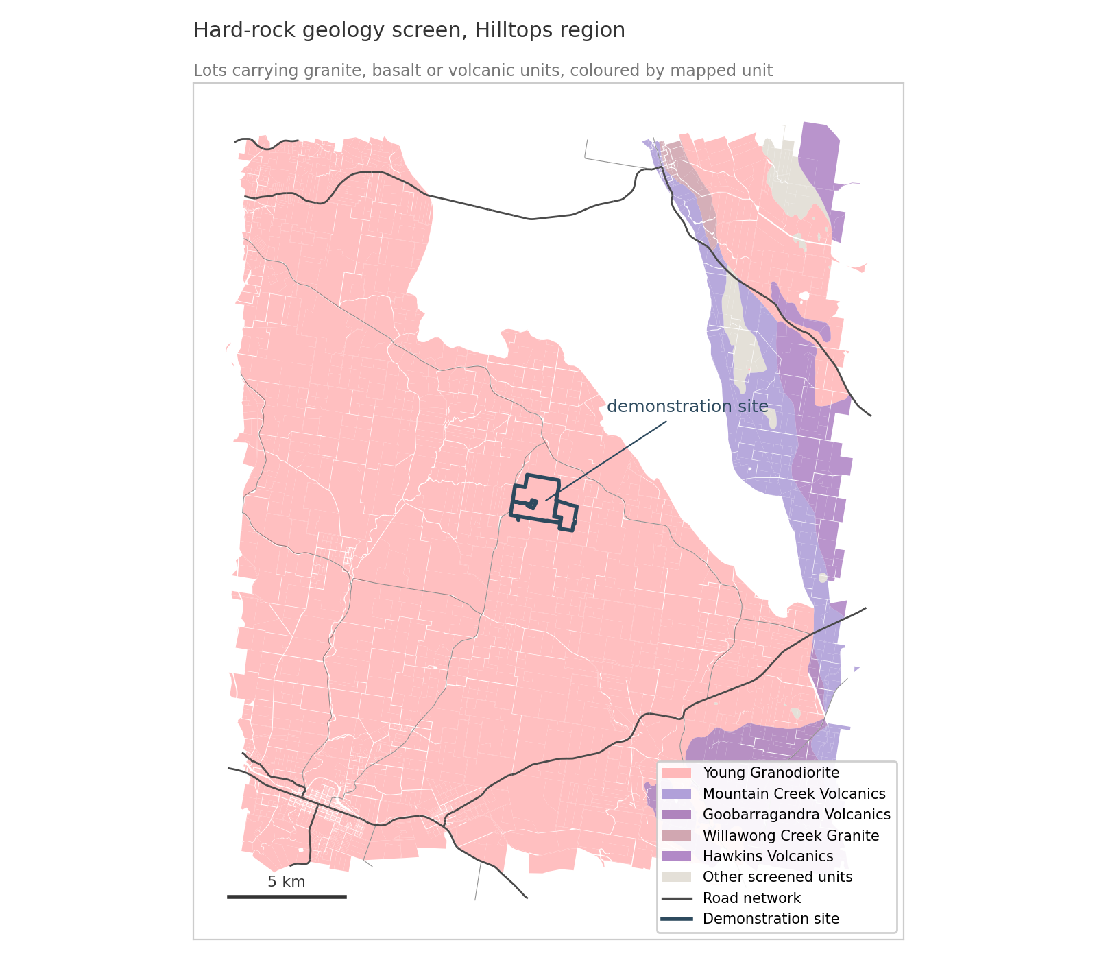
Ask anyone who has taken an extractive industry proposal through the NSW planning system and they will tell you the same thing: the rock is usually...
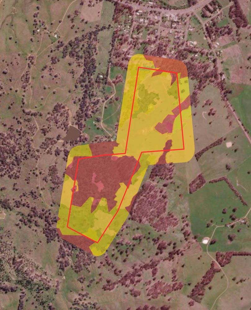
Most vendors think of due diligence as the buyer's job, something that happens after an offer is on the table. A growing number are flipping that...
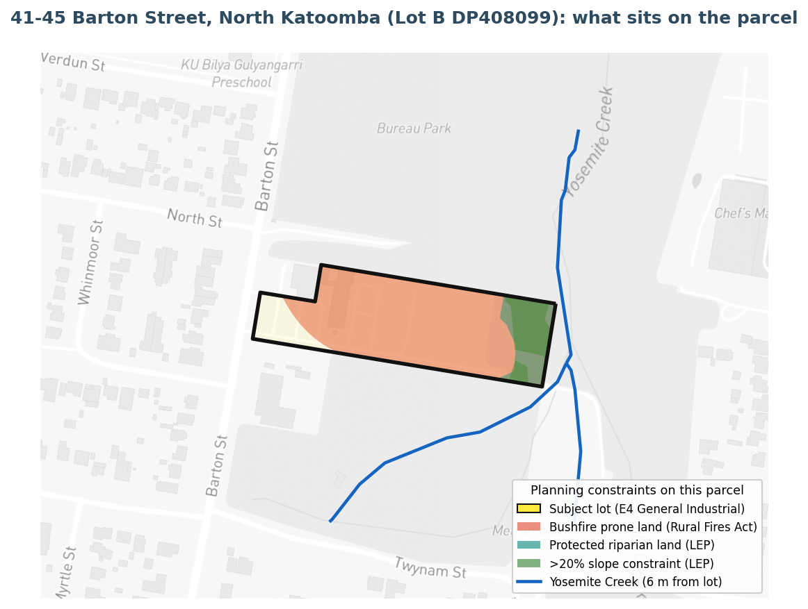
In June 2026 a Sydney builder, MAK Urban Group, withdrew its $4.8 million proposal for a data centre at 41 to 45 Barton Street in North Katoomba...

3 min read
Buying rural property in NSW means inheriting a regulatory environment that doesn't always introduce itself politely. The Biodiversity Conservation...

3 min read
Most NSW farmers reading their Native Vegetation Regulatory (NVR) map look at the coloured zones and stop there. Category 1 unregulated, Category 2...

4 min read
A NSW landowner consults the relevant government department before clearing. Gets verbal confirmation that the activity is permitted. Goes ahead....